13°52'60" N
60°58'0" W
~370m asl
10:39 (AST - UTC/GMT--4)
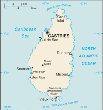
State of Saint Lucia (State of Saint Lucia) est un/une L'entité indépendante politiques (class A - Région administrative) en Saint Lucia (general), Sainte-lucie (North America), ayant le code de région Americas/Western Europe. State of Saint Lucia est situé à 370 mètres d'altitude et la population s'élève à 160,922.
State of Saint Lucia est aussi connu(e) comme Agia Loukia, Colony of Saint Lucia, Hewanorra, S:t Lucia, Saint Lucia, Saint Lucia Colony, Saint Lusia, Saint Lúsía, Sainte-Lucie, Sancte Lucia, Sankti Lusia, Sankti Lúsía, Santa Lucia, Santa Lucija, Santa Lucía, Santa Lusia, Santa Luzia, Santa Luċija, Santa Lúcia, Sejnt Lusija, Sent Lucija, Sent Lusija, Sent-Ljusija, Sent-Lucio, Sent-Lusia, Sentlusija, Sentlūsija, St Lucia, St. Lucia, State of Saint Lucia, Sv. Lucija, Svaeta Lucia, Svata Lucie, Svatá Lucie, Sveta Luchija, Sveta Lucija, Sveta Lusija, Svätá Lucia, Xan Lu-xi, Xanh Lu-xi (Saint Lucia), sant lwsya, seinteu lusia, seinteulusia, senta lusiya, sentluseiy, sentorushia, sheng lu xi ya, snt lwsya, snt lwsyh, syt lwsya, syynt lwz'yh, Αγία Λουκία, Санта Лючія, Света Лусия, Света Луција, Света Лучија, Сейнт Лусия, Сент Луција, Сент-Люсия, Сент-Люсія, Сэнт-Люсія, Սանտա Լուչիա, סיינט לוצ'יה, סנט לוסיה, سانت لوسيا, سنت لوسیا, سیت لوسیا, سینٹ لوسیا, सेंट लूसिया, सेन्ट लुसिया, সেন্ট লুসিয়া, เซนต์ลูเซีย, སེནྚ། ལུ་ཤི་ཡ།, სენტ-ლუსია, ሴንት ሉቺያ, セントルシア, 圣卢西亚, 세인트 루시아, 세인트루시아.
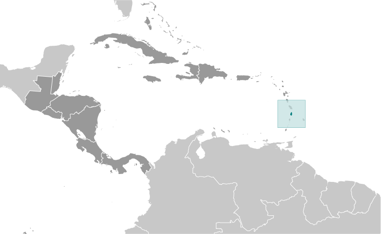
Les coordonnées géographiques sont 13°52'60" N et 60°58'0" W en DMS (degrés, minutes, secondes) ou 13.8833 et -60.9667 (en degrés décimaux). La position UTM est QA13 et la référence Joint Operation Graphics est ND20-08.
L’heure locale actuelle est 10:39; le lever du soleil est à 08:54 et le coucher du soleil est à 21:01 heure locale (America/St_Lucia UTC/GMT-4). Le fuseau horaire pour State of Saint Lucia est UTC/GMT-4
En 2024 l’heure d’été est valable de - à -.
|
Advertisements:
Advertisements:
|

 Millet (2 km)
  Morne Lacombe (2 km)
  Mount Lacombe (2 km)
  Mount Beaujolais (4 km)
  Mount Boisjolly (4 km)
  Dame de Traversay (4 km)
  Durandeau (4 km)
  Saint Lucia (4 km)
  Saint Lucia Island (4 km)
  Barre de l'Isle Ridge (4 km)
  Morne Cochon (5 km)
  Mount Cochon (5 km)
  Morne Gimie (5 km)
  Mount Gimie (5 km)
  Mount Houelmon (5 km)
  Dennery Waterworks... (5 km)
  Quilesse Forest Reserve (5 km)


