44°18'35" N
18°27'20" E
~740m asl
15:53 (CEST - UTC/GMT+2)
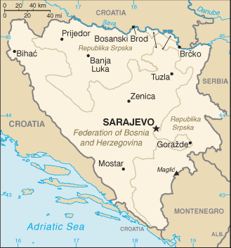
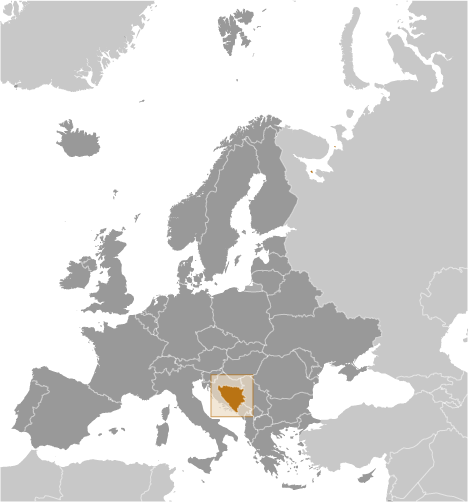
Crna Bara (Crna Bara) est un/une marais (es) (class H - hydrographique) en Bosnia and Herzegovina (general), Bosnie-herzégovine (Europe), ayant le code de région Eastern Europe. Crna Bara est situé à 740 mètres d'altitude.
Les coordonnées géographiques sont 44°18'35" N et 18°27'20" E en DMS (degrés, minutes, secondes) ou 44.3097 et 18.4556 (en degrés décimaux). La position UTM est BQ90 et la référence Joint Operation Graphics est NL34-10.
L’heure locale actuelle est 15:53; le lever du soleil est à 07:53 et le coucher du soleil est à 20:00 heure locale (Europe/Sarajevo UTC/GMT+2). Le fuseau horaire pour Crna Bara est UTC/GMT+1, mais le fuseau horaire actuel est UTC/GMT+2, parce qu’en ce moment l’heure d’été (DST) est valable.
En 2024 l’heure d’été est valable de 31 Mar 2024 à 27 Oct 2024.
A Marais (es) est un milieu humide dominé par la végétation herbacée comme.
|
Advertisements:
Advertisements:
|
Météo Crna Bara (Nébulosité, Température, Vent et Précipitation mm probab.)
Sun
Apr 28
12 °C min
22 °C max
8 km/h
Thu Jan 1
|
Mon
Apr 29
8 °C min
22 °C max
12 km/h
Thu Jan 1
|
Tue
Apr 30
7 °C min
21 °C max
14 km/h
Thu Jan 1
|
Wed
May 1
~7 l/m2 76%
7 °C min
18 °C max
9 km/h
Thu Jan 1
|
Thu
May 2
~4 l/m2 50%
9 °C min
19 °C max
11 km/h
Thu Jan 1
|
Fri
May 3
~28 l/m2 97%
7 °C min
10 °C max
7 km/h
Thu Jan 1
|
|
|
Crna Bara (Bosnia and Herzegovina (general)) prévisions à 7 jours
Carte et Les photos Crna Bara
--- Il n'y a aucun commentaire ---
Ajouter un commentaire:
|
Login
Bosnie-herzégovine (Sarajevo):
Advertisement
Points GPS pres de Crna Bara
Points GPS de Bosnie-herzégovine (Sarajevo)
 Bugar Federation Of Bosnia And Herzegovina
 Voloder Federation Of Bosnia And Herzegovina
|

 Mujica Kosa (0.5km)
  Simin Potok (0.5km)
  Zerinska Kosa (1 km)
  Modra Placa (1 km)
  Karaula (1 km)
  Lepotin Krs (1 km)
  Lipik (1 km)
  Tovarnica (1 km)
  Bojista (2 km)
  Vis (2 km)
  Brezine (2 km)
  Velike Rudine (2 km)
  Bratijevac (2 km)
  Oglavak (2 km)
  Rahmanovac (2 km)
  Maoca (2 km)
  Velika Maoca (2 km)


