0°45'41" N
41°50'47" E
~30m asl
12:41 (EAT - UTC/GMT+3)
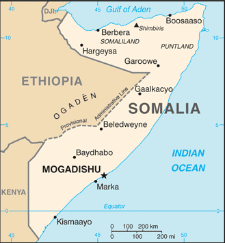
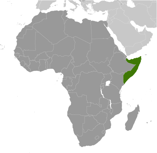
El Fangal (El Fangal) est un/une camp (s) (class S - Dossier Spot) en Lower Juba (Jubbada Hoose), Somalie (Africa), ayant le code de région Africa/Middle East. El Fangal est situé à 30 mètres d'altitude.
El Fangal est aussi connu(e) comme El Fangal, Fongal.
Les coordonnées géographiques sont 0°45'41" N et 41°50'47" E en DMS (degrés, minutes, secondes) ou 0.761389 et 41.8464 (en degrés décimaux). La position UTM est HA18 et la référence Joint Operation Graphics est NA37-16.
L’heure locale actuelle est 12:41; le lever du soleil est à 08:53 et le coucher du soleil est à 21:00 heure locale (Africa/Mogadishu UTC/GMT+3). Le fuseau horaire pour El Fangal est UTC/GMT+3
En 2024 l’heure d’été est valable de - à -.
A Camp (s) est un site occupé par des tentes, des huttes, des abris ou autres pour l'utilisation temporaire.
|
Advertisements:
Advertisements:
|
Météo El Fangal (Nébulosité, Température, Vent et Précipitation mm probab.)
Mon
Apr 29
25 °C min
32 °C max
22 km/h
Thu Jan 1
|
Tue
Apr 30
25 °C min
36 °C max
22 km/h
Thu Jan 1
|
Wed
May 1
25 °C min
36 °C max
24 km/h
Thu Jan 1
|
Thu
May 2
25 °C min
36 °C max
27 km/h
Thu Jan 1
|
Fri
May 3
25 °C min
36 °C max
26 km/h
Thu Jan 1
|
Sat
May 4
~0.4 l/m2 25%
25 °C min
34 °C max
25 km/h
Thu Jan 1
|
|
|
El Fangal (Lower Juba) prévisions à 7 jours
Carte et Les photos El Fangal
--- Il n'y a aucun commentaire ---
Ajouter un commentaire:
|
Login
Somalie (Mogadishu):
Advertisement
Points GPS pres de El Fangal
Points GPS de Somalie (Mogadishu)
 Qodli Gobolka Woqooyi Galbeed
|

 Raaja (1 km)
  Fanqal (3 km)
  Uel Gori (4 km)
  Jamar (4 km)
  Qorax Weyne (4 km)
  Wante (8 km)
  Uar Giangi (8 km)
  Uar Giangio (8 km)
  Jinja (8 km)
  Magar (9 km)
  Uar Bible (9 km)
  Bibley (9 km)
  Uar Datti Ier (10 km)
  Dhaati Yarey (10 km)
  Kamoor Dhibaayo (10 km)
  Uel Gurdubo (10 km)
  Dhibaayo (10 km)


