Sachavaca
9°12'41" S
76°7'52" W
16:23 (PET - UTC/GMT--5)
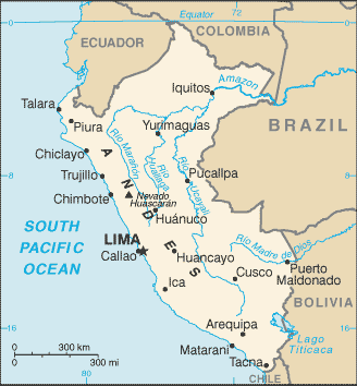
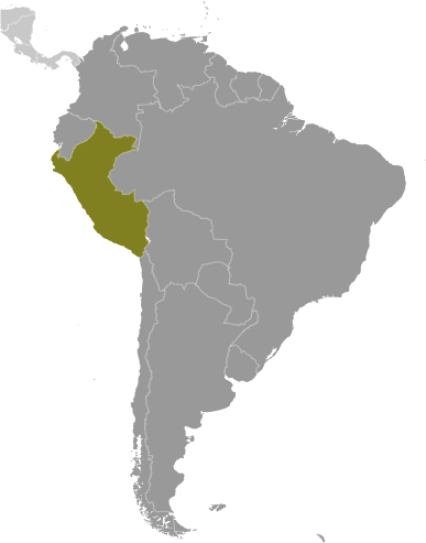
Sachavaca (Sachavaca) est un/une lieu habité (class P - des lieux habités) en (Huanuco), Pérou (South America), ayant le code de région Americas/Western Europe.
Les coordonnées géographiques sont 9°12'41" S et 76°7'52" W en DMS (degrés, minutes, secondes) ou -9.21139 et -76.1311 (en degrés décimaux). La position UTM est UQ78 et la référence Joint Operation Graphics est SC18-06.
L’heure locale actuelle est 16:23; le lever du soleil est à 08:54 et le coucher du soleil est à 21:01 heure locale (America/Lima UTC/GMT-5). Le fuseau horaire pour Sachavaca est UTC/GMT-5
En 2024 l’heure d’été est valable de - à -.
A Lieu habité est une ville, ville, village, ou de l'agglomération d'autres bâtiments où les gens vivent et travaillent.
|
Advertisements:
Advertisements:
|
Météo Sachavaca (Nébulosité, Température, Vent et Précipitation mm probab.)
Fri
Apr 26
~2 l/m2 34%
22 °C min
24 °C max
5 km/h
Thu Jan 1
|
Sat
Apr 27
~11 l/m2 50%
15 °C min
23 °C max
6 km/h
Thu Jan 1
|
Sun
Apr 28
~11 l/m2 64%
14 °C min
23 °C max
6 km/h
Thu Jan 1
|
Mon
Apr 29
~13 l/m2 61%
14 °C min
21 °C max
6 km/h
Thu Jan 1
|
Tue
Apr 30
~10 l/m2 65%
15 °C min
22 °C max
5 km/h
Thu Jan 1
|
Wed
May 1
~2 l/m2 40%
14 °C min
24 °C max
6 km/h
Thu Jan 1
|
|
|
Carte et Les photos Sachavaca
--- Il n'y a aucun commentaire ---
Ajouter un commentaire:
|
Login
Pérou (Lima):
Advertisement
Points GPS pres de Sachavaca
Points GPS de Pérou (Lima)
 Tecsi Departamento De Ayacucho
|

 Buenos Aires (3 km)
  Manchuria (5 km)
  Rio Patay Rondos (6 km)
  Rio Rondos (6 km)
  Rio Sobreviela (7 km)
  Rio Monson (8 km)
  Rio Monzon (8 km)
  Quebrada Chontayacu (9 km)
  Merced de Lacro (11 km)
  Matapalo (11 km)
  Los Cedros (11 km)
  Puente Maria (12 km)


