12°18'18" S
44°28'21" E
~649m asl
08:30 (EAT - UTC/GMT+3)
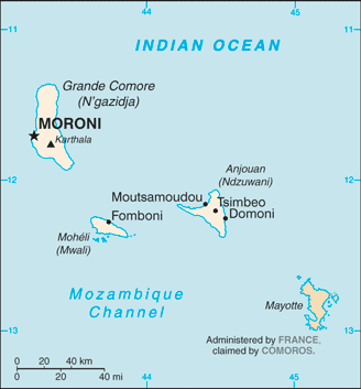
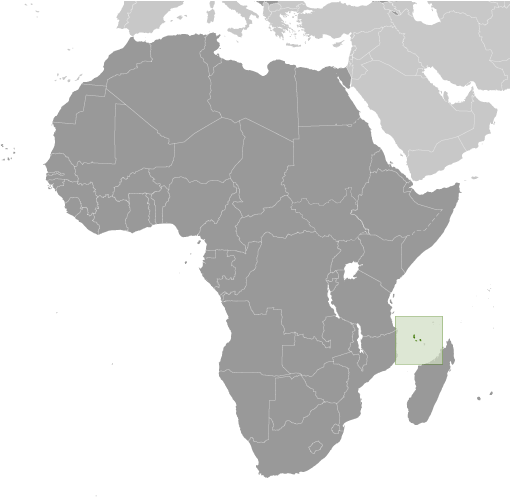
Hayja (Hayja) est un/une bâtiment (s) (class S - Dossier Spot) en Ndzuwani (Anjouan), Comores (Africa), ayant le code de région Americas/Western Europe. Hayja est situé à 649 mètres d'altitude.
Les coordonnées géographiques sont 12°18'18" S et 44°28'21" E en DMS (degrés, minutes, secondes) ou -12.305 et 44.4725 (en degrés décimaux). La position UTM est MM43 et la référence Joint Operation Graphics est SD38-02.
L’heure locale actuelle est 08:30; le lever du soleil est à 08:53 et le coucher du soleil est à 21:00 heure locale (Indian/Comoro UTC/GMT+3). Le fuseau horaire pour Hayja est UTC/GMT+3
En 2024 l’heure d’été est valable de - à -.
A Bâtiment (s) est une structure construite pour un usage permanent, comme une maison, usine, etc.
|
Advertisements:
Advertisements:
|
Météo Hayja (Nébulosité, Température, Vent et Précipitation mm probab.)
Sun
Apr 28
29 °C min
30 °C max
36 km/h
Thu Jan 1
|
Mon
Apr 29
~11 l/m2 51%
28 °C min
30 °C max
35 km/h
Thu Jan 1
|
Tue
Apr 30
~23 l/m2 74%
26 °C min
29 °C max
29 km/h
Thu Jan 1
|
Wed
May 1
~13 l/m2 71%
26 °C min
30 °C max
28 km/h
Thu Jan 1
|
Thu
May 2
~152 l/m2 96%
25 °C min
28 °C max
59 km/h
Thu Jan 1
|
Fri
May 3
~535 l/m2 96%
25 °C min
28 °C max
81 km/h
Thu Jan 1
|
|
|
Hayja (Ndzuwani) prévisions à 7 jours
Carte et Les photos Hayja
--- Il n'y a aucun commentaire ---
Ajouter un commentaire:
|
Login
Comores (Moroni):
Advertisement
Points GPS pres de Hayja
Points GPS de Comores (Moroni)
 Pessini Ile Autonome De Grande Comore
 Pidjani Ile Autonome De Grande Comore
|

 Col de Moya (0.5km)
  Kangani (0.5km)
  Chirombigo (0.5km)
  Chindrini (1 km)
  Amohoa (1 km)
  Bandajou Bangoueni (1 km)
  Assomai (1 km)
  Bouegnombe (2 km)
  Maoueni (2 km)
  Msimoukoundrou (2 km)
  Magouni-Dindi (2 km)
  Itsahou (2 km)
  Kombajou (2 km)
  Bandakouni (2 km)
  Apaji (2 km)
  Bouemoutou (2 km)
  Jandza (2 km)


