|
|
|
Advertisements:
TransportationAirports
4 (2012)
Airports - with paved runways
Total 1
2,438 to 3,047 m 1 (2012) Airports - with unpaved runways
Total 3
Under 914 m 3 (2012) Heliports
1 (2012)
Ports and terminals
Barentsburg, Longyearbyen, Ny-Alesund, Pyramiden
Commentaires
Ajouter un commentaire: |
Advertisement
Login
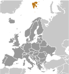
Svalbard [ Norvège ] (Norway):
 
Points GPS de Svalbard [ Norvège ] (Norway)
|
||||||||

 Tout d'abord découvert par les Norvégiens au XIIe siècle, les îles servaient une base baleinière internationale durant les XVIIe et XVIIIe siècles. La souveraineté de la Norvège a été reconnue en 1920 ; cinq ans plus tard il a pris officiellement sur le territoire.