|
|
|
Advertisements:
GeographyLocation
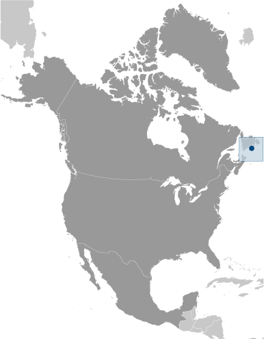
Amérique du Nord, îles dans l'océan Atlantique Nord, au sud de Terre-Neuve (Canada) Geographic coordinates
46 50 N, 56 20 W
Map references
Amérique du Nord
Area
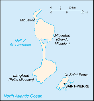
Total 242 sq km
Land 242 sq km Water 0 sq km Note Comprend huit petites îles dans le Saint Pierre et les groupes de Miquelon Area - comparative
L'un et l'autre moitié de la taille de Washington, DC fois Land boundaries
0 km
Coastline
120 km
Maritime claims
Territorial sea 12 nm
Exclusive economic zone 200 nm Climate
Froid et humide, avec très minces et le brouillard ; printemps et l'automne sont souvent venteuses Terrain
Plutôt aride rock
Elevation extremes
Lowest point Atlantic Ocean 0 m
Highest point Morne de la Grande Montagne 240 m Natural resources
Poissons, ports en eau profonde Land use
Arable land 12.5%
Permanent crops 0% Other 87.5% (2005) Irrigated land
NA
Natural hazards
Brouillard persistant tout au long de l'année, peut représenter un risque maritime Environment - current issues
Forage d'essai récent de pétrole dans les eaux autour de Saint-Pierre-et-Miquelon peut-être apporter développement futur qui serait influent sur l'environnement Geography - note
Maigre végétation
Commentaires
Ajouter un commentaire: |
Advertisement
Login
Saint-pierre-et-miquelon [ France ] (Overseas Territory):
Points GPS de Saint-pierre-et-miquelon [ France ] (Overseas Territory)
|
||||||||
 Tout d'abord colonisée par les français au début du XVIIe siècle, les îles représentent le seul vestige restant d'autrefois vastes possessions nord-américaines de la France.