|
|
|
Advertisements:
TransportationAirports
44 (2012)
Airports - with paved runways
Total 15
Over 3,047 m 1 2,438 to 3,047 m 11 1,524 to 2,437 m 3 (2012) Airports - with unpaved runways
Total 29
Over 3,047 m 2 2,438 to 3,047 m 3 1,524 to 2,437 m 23 Under 914 m 1 (2012) Heliports
1 (2012)
Railways
Total 1,908 km
Broad gauge Jauge de 1.520-m 1 908 km Note Le chemin de fer est de 50 % détenue par les chemins de fer russes Etat (2010) Roadways
Total 49,249 km
Paved 3,015 km Unpaved 46 234 km (2010) Waterways
580 km (la seule voie navigable dans l'opération est Lac Hovsgol (135 km) ; Rivière Selenge (270 km) et la rivière Orhon (175 km) sont navigables mais portent peu de circulation ; Lacs et rivières gèlent en hiver, ils sont ouverts de mai à septembre) (2010) Merchant marine
Total 57
By type En vrac transporteur 21, cargo 25, navire-citerne pour produits chimiques 1, réservoir 2, gaz liquéfié 2, passagers/fret 2, roll-on / roll-off 3, transporteur de véhicules 1 Foreign-owned 44 (Indonésie 2, Japon 2, Corée du Nord 1, Russie 2, Singapour 3, Ukraine 1, Vietnam 33) (2010)
Commentaires
Ajouter un commentaire: |
Advertisement
Login
Mongolie (Ulaanbaatar):
 
Points GPS de Mongolie (Ulaanbaatar)
|
||||||||

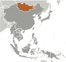 Les Mongols a gagné la renommée au XIIIe siècle lorsque sous Chinggis KHAAN, ils établirent un immense empire eurasien par la conquête. Après sa mort, l'empire a été divisée en plusieurs États puissants de Mongol, mais ceux-ci éclate au XIVe siècle. Les Mongols finit par se retire à leur patrie originale de steppe et à la fin du XVIIe siècle passa sous la domination chinoise. La Mongolie a obtenu son indépendance en 1921 avec le soutien soviétique et un régime communiste a été installé en 1924. Le pays moderne de la Mongolie, mais représente seulement une partie de la patrie historique des Mongols ; plus ethniques mongols vivent dans la région autonome de Mongolie-intérieure en République populaire de Chine qu'en Mongolie. Suite à une révolution pacifique et démocratique, Parti révolutionnaire (MPRP du peuple mongol ex-communiste) a remporté les élections en 1990 et 1992, mais est défait par la Coalition Union démocratique (DUC) lors des élections législatives de 1996. Le PPRM a remporté une majorité écrasante lors des élections législatives de 2000, mais le parti a perdu des sièges lors des élections de 2004 et partagé le pouvoir avec les partis de la coalition démocratique du 2004-08. Le PPRM a regagné une solide majorité lors des élections législatives de 2008, mais néanmoins formé un gouvernement de coalition avec le parti démocrate qui a duré jusqu'en janvier 2012. En 2010, le PPRM a voté pour reprendre le nom du parti du peuple mongol (MPP), un nom il est utilisé dans les années 1920.