1°26'39" S
5°37'25" E
~0m asl
23:04 (WAT - UTC/GMT+1)
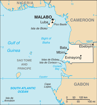
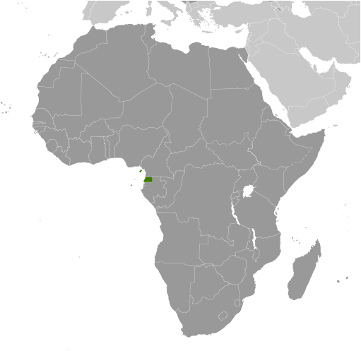
Punta Matu Mangani (Punta Matu Mangañi) est un/une point (class T - hypsographiques) en Provincia de Annobon (Annobón), Guinée équatoriale (Africa), ayant le code de région Africa/Middle East...
Les coordonnées géographiques sont 1°26'39" S et 5°37'25" E en DMS (degrés, minutes, secondes) ou -1.44417 et 5.62361 (en degrés décimaux). La position UTM est GU94 et la référence Joint Operation Graphics est SA31-08.
L’heure locale actuelle est 23:04; le lever du soleil est à 08:55 et le coucher du soleil est à 21:02 heure locale (Africa/Malabo UTC/GMT+1). Le fuseau horaire pour Punta Matu Mangani est UTC/GMT+1
En 2024 l’heure d’été est valable de - à -.
A Point est un morceau de terre s'effilant projection dans un plan d'eau, moins important que d'une cape.
|
Advertisements:
Advertisements:
|
Météo Punta Matu Mangañi (Nébulosité, Température, Vent et Précipitation mm probab.)
Mon
Apr 15
~2 l/m2 37%
28 °C min
29 °C max
16 km/h
Thu Jan 1
|
Tue
Apr 16
~19 l/m2 93%
26 °C min
29 °C max
24 km/h
Thu Jan 1
|
Wed
Apr 17
~1 l/m2 27%
27 °C min
29 °C max
20 km/h
Thu Jan 1
|
Thu
Apr 18
~7 l/m2 70%
27 °C min
29 °C max
23 km/h
Thu Jan 1
|
Fri
Apr 19
~9 l/m2 77%
27 °C min
29 °C max
38 km/h
Thu Jan 1
|
Sat
Apr 20
~0.3 l/m2 30%
27 °C min
29 °C max
21 km/h
Thu Jan 1
|
|
|
Punta Matu Mangani (Provincia de Annobon) prévisions à 7 jours
Carte et Les photos Punta Matu Mangani
--- Il n'y a aucun commentaire ---
Ajouter un commentaire:
|
Login
Guinée équatoriale (Malabo):
Advertisement
Points GPS pres de Punta Matu Mangañi
Points GPS de Guinée équatoriale (Malabo)
 Ndumo Provincia De Wele-nzas
|

 Bahia de Aval (0.5km)
  Bahia de Santa Cruz (0.5km)
  Aual (0.5km)
  Santa Cruz (0.5km)
  Punta Alvaro (0.5km)
  Punta Alvarp (0.5km)
  Punta Manamayu (0.5km)
  Punta Penvadu (0.5km)
  Punta Pegom (0.5km)
  Me Dyiliba (0.5km)
  Lapa Faanguyi (0.5km)
  Punta Culabana (0.5km)
  Punta Munamai (1 km)
  Punta Gusin (1 km)
  Punta Guesa (1 km)
  Arroyo Apala (1 km)
  Sulcado (1 km)


