|
|
Advertisements:
TransportationAirports
2 (2012)
Airports - with paved runways
Total 2
1,524 to 2,437 m 1 914 to 1,523 m 1 (2012) Railways
Total 50 km
Narrow gauge Jauge de 0,762 m 50 km à Saint-Kitts pour touristes (2008) Roadways
Total 383 km
Paved 163 km Unpaved 220 km (2002) Merchant marine
Total 152
By type En vrac transporteur 16, fret 81, navire-citerne pour produits chimiques 4, combinaison minerai/pétrole 1, réservoir 2, gaz liquéfié 3, passager 2, passagers/fret 7, pétrolier 27, fret réfrigéré 4, roll-on / roll-off tanker spécialisés 4, 1 Foreign-owned 73 (Belgique 1, Chine 1, Égypte 1, France 2, Inde 2, Japon 2, Malaisie 1, Norvège 3, Pakistan 1, Russie 13, Singapour 10, 18, Émirats Arabes Unis 8, UK 1, Ukraine 8, la Turquie nous 1) (2010) Ports and terminals
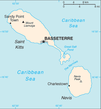
Basseterre, Charlestown
Commentaires
Ajouter un commentaire: |
Advertisement
Login
Saint-christophe-et-nevis (Basseterre):
 
Points GPS de Saint-christophe-et-nevis (Basseterre)
|
||||||||

 Indiens Caraïbes occupent les îles depuis des centaines d'années avant le début de la Britannique colonie en 1623. Les îles sont devenues un état associé du Royaume-Uni avec l'autonomie interne en 1967. L'île d'Anguilla s'est rebellée et a été autorisé à faire sécession en 1971. Saint-Kitts-et-Nevis a obtenu son indépendance en 1983. En 1998, un vote sur un référendum pour séparer de Saint-Kitts-Nevis est tombé sous la majorité des deux tiers nécessaire. Nevis continue dans ses efforts visant à séparer de Saint-Kitts.