21°20'56" N
15°45'45" W
~268m asl
11:17 (WET - UTC/GMT+0)
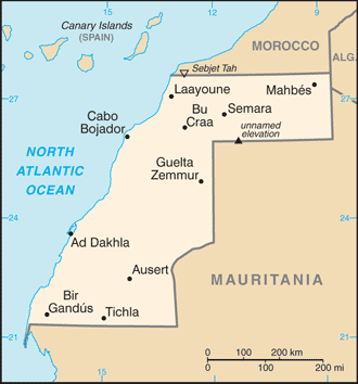
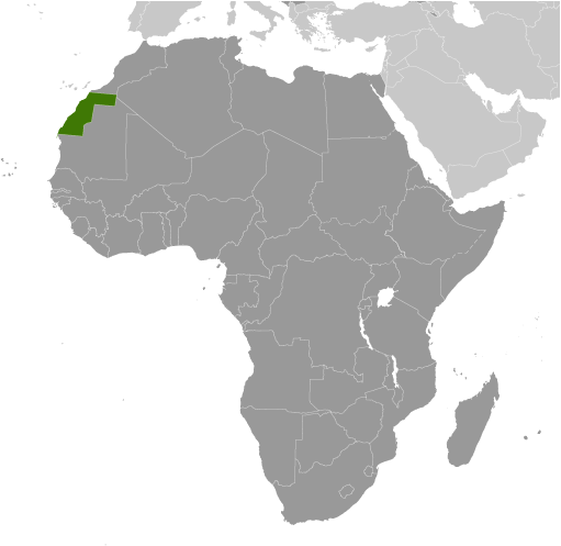
Lagwiyer Labyad (Lagwiyer Labyad) est un/une colline (class T - hypsographiques) en Western Sahara (general), Sahara Occidental [ Indéterminé ] (Africa), ayant le code de région Africa/Middle East. Lagwiyer Labyad est situé à 268 mètres d'altitude.
Lagwiyer Labyad est aussi connu(e) comme Lagwiyer Labyad, Legueir Labiad, Legüeir Labiad.
Les coordonnées géographiques sont 21°20'56" N et 15°45'45" W en DMS (degrés, minutes, secondes) ou 21.3489 et -15.7625 (en degrés décimaux). La position UTM est DJ26 et la référence Joint Operation Graphics est NF28-10.
L’heure locale actuelle est 11:17; le lever du soleil est à 08:54 et le coucher du soleil est à 21:01 heure locale (Africa/El_Aaiun UTC/GMT+0). Le fuseau horaire pour Lagwiyer Labyad est UTC/GMT+0
En 2024 l’heure d’été est valable de - à -.
A Colline est une élévation arrondie de façon limitée la hausse au-dessus des terres environnantes avec le relief local de moins de 300m.
|
Advertisements:
Advertisements:
|
Météo Lagwiyer Labyad (Nébulosité, Température, Vent et Précipitation mm probab.)
Wed
Apr 24
22 °C min
38 °C max
18 km/h
Thu Jan 1
|
Thu
Apr 25
23 °C min
36 °C max
40 km/h
Thu Jan 1
|
Fri
Apr 26
~1 l/m2 48%
25 °C min
29 °C max
40 km/h
Thu Jan 1
|
Sat
Apr 27
20 °C min
33 °C max
25 km/h
Thu Jan 1
|
Sun
Apr 28
17 °C min
32 °C max
30 km/h
Thu Jan 1
|
Mon
Apr 29
18 °C min
32 °C max
34 km/h
Thu Jan 1
|
|
|
Lagwiyer Labyad (Western Sahara (general)) prévisions à 7 jours
Carte et Les photos Lagwiyer Labyad
--- Il n'y a aucun commentaire ---
Ajouter un commentaire:
|
Login
Sahara Occidental [ Indéterminé ] (El Aaiun):
Advertisement
Points GPS pres de Lagwiyer Labyad
Points GPS de Sahara Occidental [ Indéterminé ] (El Aaiun)
 Deboub Western Sahara (general)
Lahfor Western Sahara (general)
|