13°25'60" N
15°22'0" W
~2m asl
06:29 (GMT - UTC/GMT+0)
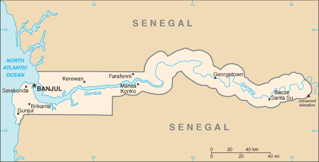
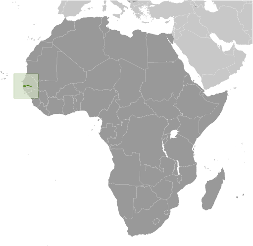
Bantanding Bolon (Bantanding Bolon) est un/une flux (class H - hydrographique) en Lower River Division (Gambia, The (general)), Gambie (Africa), ayant le code de région Africa/Middle East. Bantanding Bolon est situé à 2 mètres d'altitude.
Bantanding Bolon est aussi connu(e) comme Bantanding Bolon, Bantending Bolon.
Les coordonnées géographiques sont 13°25'60" N et 15°22'0" W en DMS (degrés, minutes, secondes) ou 13.4333 et -15.3667 (en degrés décimaux). La position UTM est DV68 et la référence Joint Operation Graphics est ND28-10.
L’heure locale actuelle est 06:29; le lever du soleil est à 08:55 et le coucher du soleil est à 21:02 heure locale (Africa/Banjul UTC/GMT+0). Le fuseau horaire pour Bantanding Bolon est UTC/GMT+0
En 2024 l’heure d’été est valable de - à -.
A Flux est un corps en mouvement de l'eau courante à un niveau inférieur dans un canal sur la terre.
|
Advertisements:
Advertisements:
|
Météo Bantanding Bolon (Nébulosité, Température, Vent et Précipitation mm probab.)
Thu
Apr 18
42 °C min
43 °C max
16 km/h
Thu Jan 1
|
Fri
Apr 19
27 °C min
45 °C max
20 km/h
Thu Jan 1
|
Sat
Apr 20
24 °C min
43 °C max
14 km/h
Thu Jan 1
|
Sun
Apr 21
22 °C min
40 °C max
24 km/h
Thu Jan 1
|
Mon
Apr 22
20 °C min
39 °C max
21 km/h
Thu Jan 1
|
Tue
Apr 23
20 °C min
39 °C max
24 km/h
Thu Jan 1
|
|
|
Bantending Bolon (Lower River Division) prévisions à 7 jours
Carte et Les photos Bantanding Bolon
--- Il n'y a aucun commentaire ---
Ajouter un commentaire:
|
Login
Gambie (Banjul):
Advertisement
Points GPS pres de Bantanding Bolon
Points GPS de Gambie (Banjul)
|

 Jassong Bolon (3 km)
  Jassong Creek (3 km)
  Badume (3 km)
  Naneko (3 km)
  Kanuma (4 km)
  Nema (4 km)
  Sitafuma (4 km)
  Wellingara Ba (4 km)
  Willingara (4 km)
  Elephant Island (4 km)
  Daru Fatiho (4 km)
  Forlolor (5 km)
  Hamdalai (5 km)
  Jalaba (5 km)
  Central Jarra (5 km)
  Jafini (5 km)
  Jappeni (5 km)


