26°30'0" S
31°30'0" E
~592m asl
11:12 (SAST - UTC/GMT+2)
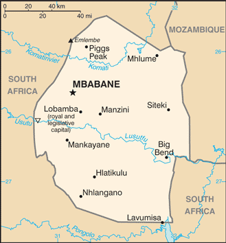
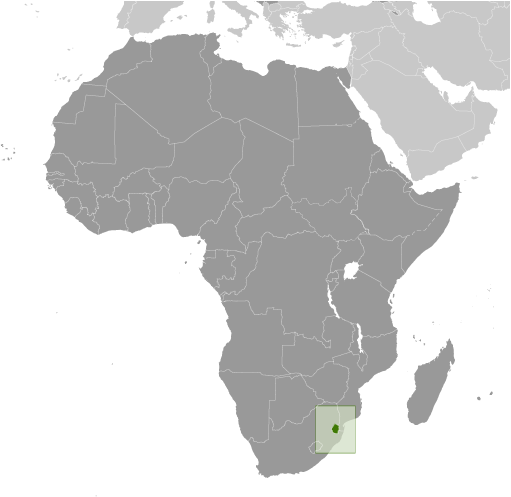
Hlokohla (Hlokohla) est un/une montagne (class T - hypsographiques) en Swaziland (general), Swaziland (Africa), ayant le code de région Africa/Middle East. Hlokohla est situé à 592 mètres d'altitude et la population s'élève à 1,354,051.
Hlokohla est aussi connu(e) comme An tSuasalainn, Gwlad Swazi, Kingdom of Swaziland, Ngwane, Pow Swati, Siwaziland, Souazilande, Suacilandia, Suacilandia - Swaziland, Suazi, Suazia, Suazilandia, Suazilend, Suazilândia, Svaasimaa, Svasiland, Svasiyaen, Svasiyän, Svasíland, Svazi, Svazieana, Svazijsko, Svaziland, Svazilandas, Svazilande, Svazilando, Svazilandë, Svazilend, Svazilenda, Svazilendas, Swasieland, Swasiland, Swasilandya, Swasisuyu, Swazijsko, Swaziland, Swazilande, Swazilandia, Swazilando, Swazilàndia, Swazimaa, Sważiland, Szvazifoeld, Szváziföld, Umbuso weSwatini, Uswazi, Xoa-di-len, Zouazilande, seuwajillaendeu, seuwajillandeu, si wei shi lan, soyajilyanda, su'ajilainda, suwajirando, suwajirando wang guo, svajilainda, svazilainda, svazilendi, svazyland, swazyland, swazylnd, swwzylnd, Ζουαζιλάνδη, Σουαζιλάνδη, Свазиленд, Свазіленд, Суазиленд, Սվազիլենդ, סוואזילנד, סווזילנד, سوازيلاند, سوازيلند, سوازی لینڈ, سوازیلاند, سوازیلند, سۋازىلاند, सुआजीलैंड, स्वाज़ीलैंड, स्वाजीलैंड, সোয়াজিল্যান্ড, ประเทศสวาซิแลนด์, สวาซิแลนด์, ສະວາຊິແລນ, სვაზილენდი, ሱዋዚላንድ, ስዋዚላንድ, សូហ្ស៉ីឡង់, スワジランド, スワジランド王国, 斯威士兰, 스와질란드, 스와질랜드.
Les coordonnées géographiques sont 26°30'0" S et 31°30'0" E en DMS (degrés, minutes, secondes) ou -26.5 et 31.5 (en degrés décimaux). La position UTM est UR56 et la référence Joint Operation Graphics est SG36-10.
L’heure locale actuelle est 11:12; le lever du soleil est à 08:55 et le coucher du soleil est à 21:02 heure locale (Africa/Mbabane UTC/GMT+2). Le fuseau horaire pour Hlokohla est UTC/GMT+2
En 2024 l’heure d’été est valable de - à -.
A Montagne est un pied d'élévation au-dessus de la zone environnante avec coin petit sommet, les pentes raides et de secours local de 300 m ou plus.
|
Advertisements:
Advertisements:
|

 Saint Josephs (4 km)
  Umbanjane Kop (5 km)
  Saddle (6 km)
  Mbutini Hills (10 km)
  Luzinyane Kop (11 km)
  Njingo (11 km)


