English   Română   Español   Français   Deutsch  

getamap.net

Afrique

Oceanie

Asie

Amerique du Nord

Europe

Amerique du Sud

L'Antarctique


Batbank

/ Northern Province

8°25'60" N
12°55'60" W
~30m asl
09:07 (GMT - UTC/GMT+0)

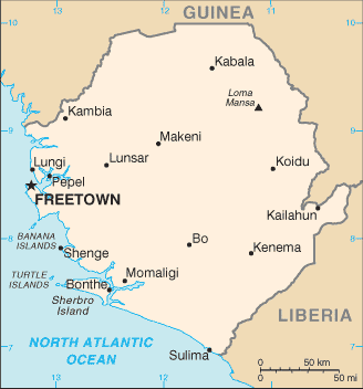
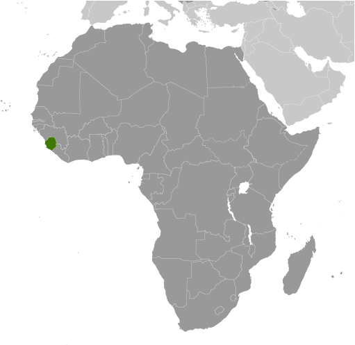
Batbank (Batbank) est un/une flux (class H - hydrographique) en Northern Province (Northern), Sierra Leone (Africa), ayant le code de région Africa/Middle East. Batbank est situé à 30 mètres d'altitude.

Les coordonnées géographiques sont 8°25'60" N et 12°55'60" W en DMS (degrés, minutes, secondes) ou 8.43333 et -12.9333 (en degrés décimaux). La position UTM est GQ23 et la référence Joint Operation Graphics est NC28-16.

L’heure locale actuelle est 09:07; le lever du soleil est à 08:54 et le coucher du soleil est à 21:01 heure locale (Africa/Freetown UTC/GMT+0). Le fuseau horaire pour Batbank est UTC/GMT+0
En 2024 l’heure d’été est valable de - à -.

A Flux est un corps en mouvement de l'eau courante à un niveau inférieur dans un canal sur la terre.


Country
 Advertisements:


 Advertisements:


Météo Batbank (Nébulosité, Température, Vent et Précipitation mm probab.)

Thu


Apr 25
Clound 0-0-10-70
 
24 °C min
36 °C max
14 km/h
Thu Jan 1

Fri


Apr 26
Clound 0-10-40-90
 
25 °C min
36 °C max
14 km/h
Thu Jan 1

Sat


Apr 27
Clound 0-10-40-80
~1 l/m2 54%
 
24 °C min
36 °C max
15 km/h
Thu Jan 1

Sun


Apr 28
Clound 0-20-20-60 Lightning
 
24 °C min
36 °C max
14 km/h
Thu Jan 1

Mon


Apr 29
Clound 0-30-40-60 Lightning
 
26 °C min
38 °C max
11 km/h
Thu Jan 1

Tue


Apr 30
Clound 0-20-10-60 Lightning
~1 l/m2 17%
 
25 °C min
37 °C max
15 km/h
Thu Jan 1

Météo Graph

Batbank (Northern Province) prévisions à 7 jours
 

Carte et Les photos Batbank


Commentaires

--- Il n'y a aucun commentaire ---


Ajouter un commentaire:


Vous devez vous connecter pour ajouter un commentaire!


Login


Register

Mot de passe oublié ?

Sierra Leone (Freetown):

Advertisement


Points GPS pres de Batbank

square Gbabai (1 km)

square Matiri (2 km)

square Mamara (2 km)

square Masimbara (2 km)

square Magbenta (3 km)

square Magbuntubana (4 km)

square Bake Mamule (4 km)

square Batbana (4 km)

square Kakande (5 km)

square Gbero (5 km)

square Gboro (5 km)

square Rokon (5 km)

square Mamaliki (5 km)

square Mabamba (5 km)

square Mafengeri (5 km)

square Futa (5 km)

square Makolo (5 km)


Points GPS de Sierra Leone (Freetown)

square Joborhu Eastern Province

square Basia Northern Province

square Aku Town Northern Province

square Fomaya Eastern Province

square Molakul Southern Province

square Kensekoro Northern Province

square Pendembu Southern Province

square Mafari Northern Province


viewweather.com sv.ViewWeather.com
fr.ViewWeather.com
da.ViewWeather.com
de.ViewWeather.com
es.ViewWeather.com
www.carpati.org
www.searchromania.net
Deblocari usi
es.getamap.org
fr.getamap.org
de.getamap.org
nl.getamap.org
da.getamap.org
www.getamap.org
Liens
Conditions d'utilisation
Politique de confidentialité

# 0.0657 sec 

contact AT getamap.net

© 2006 - 2024  https://fr.getamap.net/