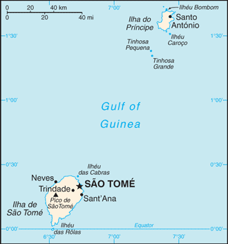
Saint Thomas Island (Ilha de Sao Tome) / Sao Tome
0°12'0" N
6°39'0" E
~244m asl
13:03 (GMT - UTC/GMT+0)
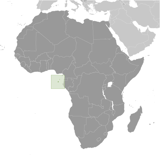
Saint Thomas Island (Saint Thomas Island) est un/une île (class T - hypsographiques) en Sao Tome (São Tomé), Sao Tome Et Principe (Africa), ayant le code de région Americas/Western Europe. Saint Thomas Island est situé à 244 mètres d'altitude.
Saint Thomas Island est aussi connu(e) comme Ile San Thome, Ilha de Sao Tome, Ilha de São Tomé, Isla de Santo Tome, Isla de Santo Tomé, Isla de Sao-Thome, Isla de São-Thomé, Saint Thomas Island, Île San Thomé.
Les coordonnées géographiques sont 0°12'0" N et 6°39'0" E en DMS (degrés, minutes, secondes) ou 0.2 et 6.65 (en degrés décimaux). La position UTM est KF32 et la référence Joint Operation Graphics est NA32-13.
L’heure locale actuelle est 13:03; le lever du soleil est à 08:54 et le coucher du soleil est à 21:01 heure locale (Africa/Sao_Tome UTC/GMT+0). Le fuseau horaire pour Saint Thomas Island est UTC/GMT+0
En 2024 l’heure d’été est valable de - à -.
A île est une parcelle de terrain, plus petit qu'un continent, entourée par l'eau à marée haute.
|
Advertisements:
Advertisements:
|
Météo Saint Thomas Island (Nébulosité, Température, Vent et Précipitation mm probab.)
Thu
Apr 25
28 °C min
30 °C max
17 km/h
Thu Jan 1
|
Fri
Apr 26
28 °C min
30 °C max
15 km/h
Thu Jan 1
|
Sat
Apr 27
28 °C min
30 °C max
13 km/h
Thu Jan 1
|
Sun
Apr 28
~4 l/m2 35%
28 °C min
30 °C max
18 km/h
Thu Jan 1
|
Mon
Apr 29
~9 l/m2 55%
28 °C min
30 °C max
18 km/h
Thu Jan 1
|
Tue
Apr 30
~14 l/m2 76%
28 °C min
30 °C max
14 km/h
Thu Jan 1
|
|
|
Ilha de Sao Tome (Sao Tome) prévisions à 7 jours
Carte et Les photos Saint Thomas Island
--- Il n'y a aucun commentaire ---
Ajouter un commentaire:
|
Login
Sao Tome Et Principe (Sao Tome):
Advertisement
Points GPS pres de Saint Thomas Island
Points GPS de Sao Tome Et Principe (Sao Tome)
|
 Antonio Dias (1 km)