Tullah Creek (Talla Dor) / Sindh
24°49'0" N
66°58'0" E
~0m asl
23:53 (PKT - UTC/GMT+5)
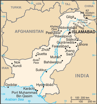
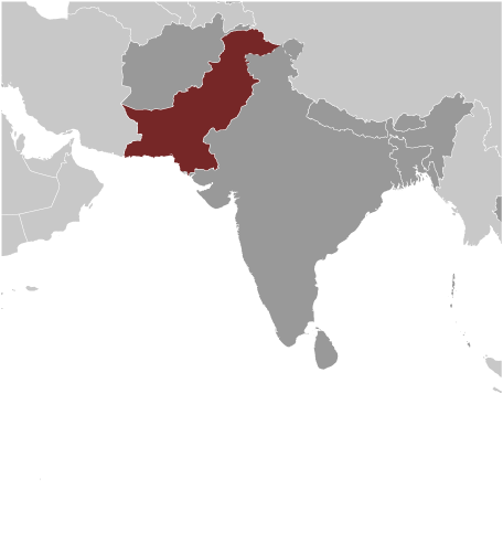
Tullah Creek (Tullah Creek) est un/une chenal de marée (s) (class H - hydrographique) en Sindh, Pakistan (Asia), ayant le code de région Asia/Pacific...
Tullah Creek est aussi connu(e) comme Talla Dor, Tullah Creek.
Les coordonnées géographiques sont 24°49'0" N et 66°58'0" E en DMS (degrés, minutes, secondes) ou 24.8167 et 66.9667 (en degrés décimaux). La position UTM est TN94 et la référence Joint Operation Graphics est NG42-13.
L’heure locale actuelle est 23:53; le lever du soleil est à 08:55 et le coucher du soleil est à 21:02 heure locale (Asia/Karachi UTC/GMT+5). Le fuseau horaire pour Tullah Creek est UTC/GMT+5
En 2024 l’heure d’été est valable de - à -.
A Chenal de marée (s) est un canal à méandres dans un sujet des terres humides côtières à bi-directionnelle des courants de marée.
|
Advertisements:
Advertisements:
|
Météo Tullah Creek (Nébulosité, Température, Vent et Précipitation mm probab.)
Fri
Apr 19
25 °C min
26 °C max
36 km/h
Thu Jan 1
|
Sat
Apr 20
24 °C min
31 °C max
37 km/h
Thu Jan 1
|
Sun
Apr 21
25 °C min
31 °C max
41 km/h
Thu Jan 1
|
Mon
Apr 22
25 °C min
31 °C max
39 km/h
Thu Jan 1
|
Tue
Apr 23
25 °C min
30 °C max
36 km/h
Thu Jan 1
|
Wed
Apr 24
25 °C min
30 °C max
33 km/h
Thu Jan 1
|
|
|
Talla Dor (Sindh) prévisions à 7 jours
Carte et Les photos Tullah Creek
--- Il n'y a aucun commentaire ---
Ajouter un commentaire:
|
Login
Pakistan (Islamabad):
Advertisement
Points GPS pres de Tullah Creek
Points GPS de Pakistan (Islamabad)
 Ghundakai Federally Administered Tribal Areas
 Chakli North West Frontier Province
|

 Karachi Harbour (0.5km)
  Bhit Island (0.5km)
  Bunker Island (0.5km)
  Baba Island (0.5km)
  Salehabad Island (1 km)
  Keamari Area (1 km)
  Kiamari (1 km)
  Baba Channel (1 km)
  Goth Shaikhan (1 km)
  Yari Creek (1 km)
  Yariri Creek (1 km)
  Yarri Creek (1 km)
  Napier Mole (2 km)
  Babberwala Dor (2 km)
  Chachi Dor (2 km)
  Karachi Manora (3 km)
  Manora (3 km)


