27°0'0" N
30°0'0" E
~188m asl
16:45 (EET - UTC/GMT+2)
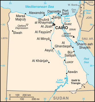
Jumhuriyat Misr al `Arabiyah (Jumhūrīyat Mişr al `Arabīyah) est un/une L'entité indépendante politiques (class A - Région administrative) en Egypt (general), Egypte (Africa), ayant le code de région Africa/Middle East. Jumhuriyat Misr al `Arabiyah est situé à 188 mètres d'altitude et la population s'élève à 80,471,869.
Jumhūrīyat Mişr al `Arabīyah est aussi connu(e) comme 'Isipite, AEgypten, Aegyptus, Agypten, Ai Cap, Ai Cập, Aigyptos, Aikupito, Al Iqlim al Janubi, Al Iqlim al Misri, Al Iqlīm al Janūbī, Al Iqlīm al Mişrī, Al Jumhuriyah al Misriyah, Al Jumhuriyah al `Arabiyah al Muttahidah, Al Jumhūrīyah al Miṣrīyah, Al Jumhūrīyah al ‘Arabīyah al Muttaḩidah, An Eigipt, An Eiphit, An Éigipt, Arab Republic of Egypt, Eajipt, Echipto, Eggittu, Egipat, Egipet, Egipt, Egiptas, Egipte, Egiptia, Egiptio, Egipto, Egiptos, Egiptus, Egito, Egitto, Egittu, Egjipt, Egjipti, Egyiptom, Egypt, Egypta, Egyptaland, Egypte, Egypten, Egypti, Egypto, Egyptowska, Ehipto, Ejip, Ejipti, Ejyp, El Masr, El Qutr el Masri, Exipto, Exipto - msr, Exipto - مصر, Eġittu, Ijipta, Jumhuriyat Misr al `Arabiyah, Jumhūrīyat Mişr al ‘Arabīyah, Laegueptaen, Lägüptän, Masar, Mesir, Misir, Misr, Misri, Mysyr, Mısır, Naggitto, Republic of Egypt, United Arab Republic, Yr Aifft, ai ji, ejiputo, ekiptu, ijibteu, ijipt, ijipta, misara, misra, mistra, msr, msrn, msryn, mysyr, mzrym, prathes xiyipt, xiyipt, Ägypten, Ægypten, Èg·ipte, Égypte, Êgypte, Ēģipte, ʻIsipite, Αίγυπτος, Єгипет, Египат, Египет, Егіпет, Егѵпьтъ, Миср, Мысыр, Эгіпет, Եգիպտոս, מצרים, مصر, مىسىر, ܡܨܪܝܢ, ܡܨܪܢ, इजिप्त, मिस्त्र, मिस्र, মিশর, મિસર, எகிப்து, ഈജിപ്ത്, ഈജിപ്റ്റ്, ประเทศอียิปต์, อียิปต์, ອີຢິບ, ཨི་ཇིཔཊ, ཨི་ཇིབྚ།, ეგვიპტე, ግብጽ, ግብፅ, អេហ្ស៉ីប, エジプト, エジプト・アラブ共和国, 埃及, 이집트.
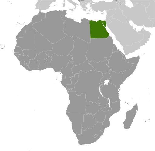
Les coordonnées géographiques sont 27°0'0" N et 30°0'0" E en DMS (degrés, minutes, secondes) ou 27 et 30 (en degrés décimaux). La position UTM est TQ08 et la référence Joint Operation Graphics est NG36-00.
L’heure locale actuelle est 16:45; le lever du soleil est à 08:55 et le coucher du soleil est à 21:02 heure locale (Africa/Cairo UTC/GMT+2). Le fuseau horaire pour Jumhuriyat Misr al `Arabiyah est UTC/GMT+2
En 2024 l’heure d’été est valable de - à -.
|
Advertisements:
Advertisements:
|


