East Diamond Island
17°26'30" S
151°4'30" E
( - UTC/GMT+)
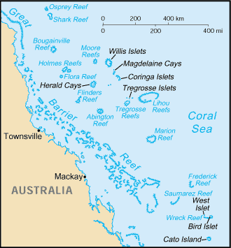
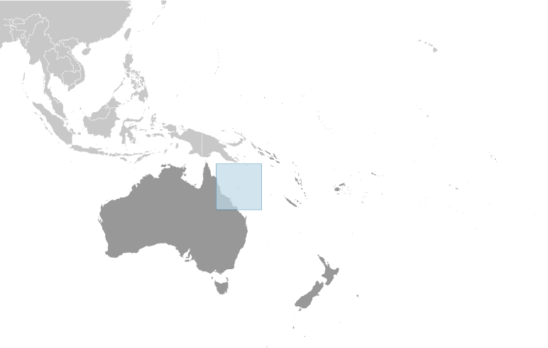
East Diamond Island (East Diamond Island) est un/une île (class T - hypsographiques) en (Coral Sea Islands (general)), îles De La Mer Corail [ Australie ] (Oceania), ayant le code de région Americas/Western Europe.
Les coordonnées géographiques sont 17°26'30" S et 151°4'30" E en DMS (degrés, minutes, secondes) ou -17.4417 et 151.075 (en degrés décimaux). La position UTM est KF97 et la référence Joint Operation Graphics est SE56-05.
L’heure locale actuelle est ; le lever du soleil est à 08:54 et le coucher du soleil est à 21:01 heure locale ( UTC/GMT+). Le fuseau horaire pour East Diamond Island est UTC/GMT+
En 2024 l’heure d’été est valable de - à -.
A île est une parcelle de terrain, plus petit qu'un continent, entourée par l'eau à marée haute.
|
Advertisements:
Advertisements:
|
Météo East Diamond Island (Nébulosité, Température, Vent et Précipitation mm probab.)
Wed
Apr 24
25 °C min
26 °C max
27 km/h
Thu Jan 1
|
Thu
Apr 25
~0.5 l/m2 21%
25 °C min
27 °C max
31 km/h
Thu Jan 1
|
Fri
Apr 26
25 °C min
27 °C max
35 km/h
Thu Jan 1
|
Sat
Apr 27
~1 l/m2 14%
25 °C min
27 °C max
39 km/h
Thu Jan 1
|
Sun
Apr 28
~4 l/m2 51%
25 °C min
27 °C max
43 km/h
Thu Jan 1
|
Mon
Apr 29
~0.4 l/m2 16%
26 °C min
27 °C max
39 km/h
Thu Jan 1
|
|
|
Carte et Les photos East Diamond Island
--- Il n'y a aucun commentaire ---
Ajouter un commentaire:
|
Login
îles De La Mer Corail [ Australie ]:
Advertisement
Points GPS pres de East Diamond Island
Points GPS de îles De La Mer Corail [ Australie ]
|