Île Diable
5°21'0" S
72°12'0" E
02:02 (IOT - UTC/GMT+6)
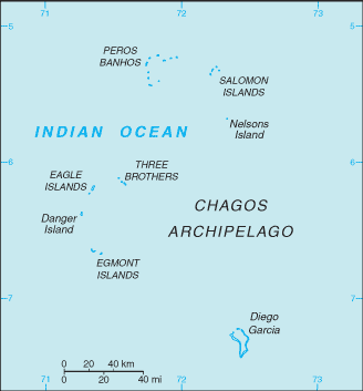
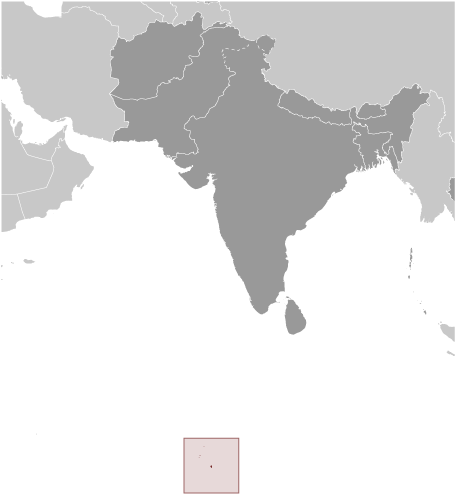
Ile Diable (Île Diable) est un/une île (class T - hypsographiques) en (British Indian Ocean Territory (general)), Territoire Britannique De L'ocean Indien [ Royaume-uni ] (Asia), ayant le code de région Americas/Western Europe.
Les coordonnées géographiques sont 5°21'0" S et 72°12'0" E en DMS (degrés, minutes, secondes) ou -5.35 et 72.2 (en degrés décimaux). La position UTM est AQ80 et la référence Joint Operation Graphics est SB43-05.
L’heure locale actuelle est 02:02; le lever du soleil est à 08:54 et le coucher du soleil est à 21:01 heure locale (Indian/Chagos UTC/GMT+6). Le fuseau horaire pour Ile Diable est UTC/GMT+6
En 2024 l’heure d’été est valable de - à -.
A île est une parcelle de terrain, plus petit qu'un continent, entourée par l'eau à marée haute.
|
Advertisements:
Advertisements:
|
Météo Île Diable (Nébulosité, Température, Vent et Précipitation mm probab.)
Tue
Apr 23
~2 l/m2 22%
28 °C min
29 °C max
23 km/h
Thu Jan 1
|
Wed
Apr 24
~10 l/m2 59%
28 °C min
29 °C max
31 km/h
Thu Jan 1
|
Thu
Apr 25
~1 l/m2 48%
28 °C min
29 °C max
31 km/h
Thu Jan 1
|
Fri
Apr 26
~0.4 l/m2 20%
28 °C min
29 °C max
28 km/h
Thu Jan 1
|
Sat
Apr 27
~8 l/m2 48%
28 °C min
29 °C max
26 km/h
Thu Jan 1
|
Sun
Apr 28
~10 l/m2 64%
26 °C min
29 °C max
23 km/h
Thu Jan 1
|
|
|
Carte et Les photos Ile Diable
--- Il n'y a aucun commentaire ---
Ajouter un commentaire:
|
Login
Territoire Britannique De L'ocean Indien [ Royaume-uni ] (Overseas Territory):
Advertisement
Points GPS pres de Île Diable
Points GPS de Territoire Britannique De L'ocean Indien [ Royaume-uni ] (Overseas Territory)
 East Point British Indian Ocean Territory (general)
|