|
|
|
Advertisements:
TransportationAirports
61 (2012)
Airports - with paved runways
Total 22
Over 3,047 m 2 2,438 to 3,047 m 2 1,524 to 2,437 m 13 914 to 1,523 m 5 (2012) Airports - with unpaved runways
Total 39
1,524 to 2,437 m 4 914 to 1,523 m 15 Under 914 m 20 (2012) Heliports
1 (2012)
Roadways
Total 2,717 km
Paved 1,560 km Unpaved 1 157 km (2002) Merchant marine
Total 1,160
By type Le chaland transporteur 1, vraquier 238, fret 170, transporteur 2, chimiquier 87, combinaison minerai/huile 8, contenant 57, gaz liquéfié 71, passager 102, 26 passagers et du fret, pétrolier 225, fret réfrigéré 97, roll-on / roll-off 13, citerne spécialisé 2, transporteur de véhicule 61 Foreign-owned 1 063 (Angola 6, Bermudes 15, Brésil 1, Canada 96, Croatie 1, Chypre 23, Danemark 69, Finlande 8, France 15, Allemagne 30, Grèce 225, Guernesey 6, Hong Kong 3, Indonésie 2, France 3, Italie 1, Australie 1, Belgique 6 Japon 88, Jordan 2, Koweït 1, Malaisie 13, Monaco 8, Monténégro 2, Pays-Bas 23, Nigéria 2, Norvège 186, Pologne 34, Arabie saoudite, 16Singapour 7, Corée du Sud 1, Espagne 6, Suède 11, Suisse 1, Thaïlande 4, Turquie 3, Émirats Arabes Unis 23, UK 18, U.S. 109) Registered in other countries 6 (Panama 6) (2010)Ports and terminals
Freeport, Nassau, South Riding Point
Commentaires
Ajouter un commentaire: |
Advertisement
Login
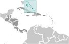
Bahamas (Nassau):
 
Points GPS de Bahamas (Nassau)
|
||||||||

 Indiens lucayens habitaient ces îles lorsque Christophe Colomb tout d'abord mis les pieds dans le nouveau monde à San Salvador en 1492. La colonie britannique des îles a commencé en 1647 ; les îles sont devenues une colonie en 1783. Depuis leur indépendance du Royaume-Uni en 1973, les Bahamas a prospéré grâce au tourisme et de la gestion bancaire et de l'investissement internationale. En raison de sa géographie, le pays est un point de transbordement majeur pour les drogues illicites, notamment des expéditions vers les États-Unis et l'Europe, et son territoire est utilisé pour la contrebande de migrants illégaux vers les États-Unis.