|
|
|
Advertisements:
GeographyLocation
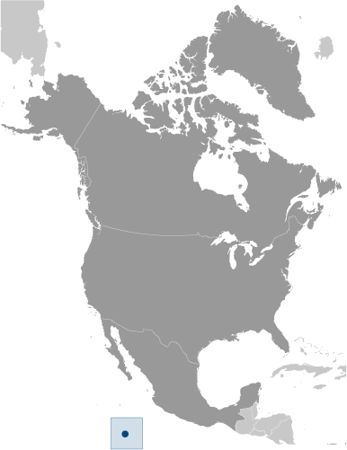
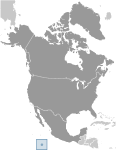
Middle America, atoll situé dans l'océan Pacifique Nord, 1 120 km au sud-ouest du Mexique Geographic coordinates
10 17 N, 109 13 W
Map references
Carte politique du monde
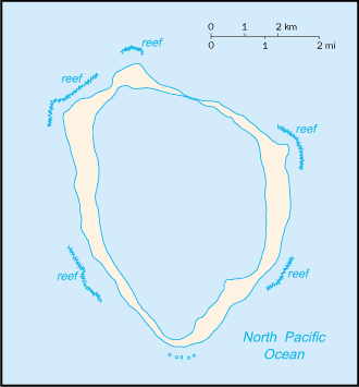
Area
Total 6 sq km
Land 6 sq km Water 0 sq km Area - comparative
Environ 12 fois la taille du centre commercial The Mall à Washington, D.C. Land boundaries
0 km
Coastline
11.1 km
Maritime claims
Territorial sea 12 nm
Exclusive economic zone 200 nm Climate
Tropical ; température humide, une moyenne 20-32 degrés C, la saison des pluies (de mai à octobre) Terrain
Atoll de corail
Elevation extremes
Lowest point Pacific Ocean 0 m
Highest point Rocher Clipperton 29 m Natural resources
Fish
Land use
Arable land 0%
Permanent crops 0% Other 100% (all coral) (2005) Irrigated land
0 sq km
Natural hazards
NA
Environment - current issues
NA
Geography - note
12 km de circonférence de récif
Commentaires
Ajouter un commentaire: |
Advertisement
Login
L'île De Clipperton [ France ]:
  |
||||||||
 Cette île isolée a été nommée pour John CLIPPERTON, un pirate qui en fit sa cachette tôt au 18ème siècle. Annexée par la France en 1855, il a été saisi par le Mexique en 1897. Arbitrage reçoit finalement l'île à la France, qui a pris possession en 1935.